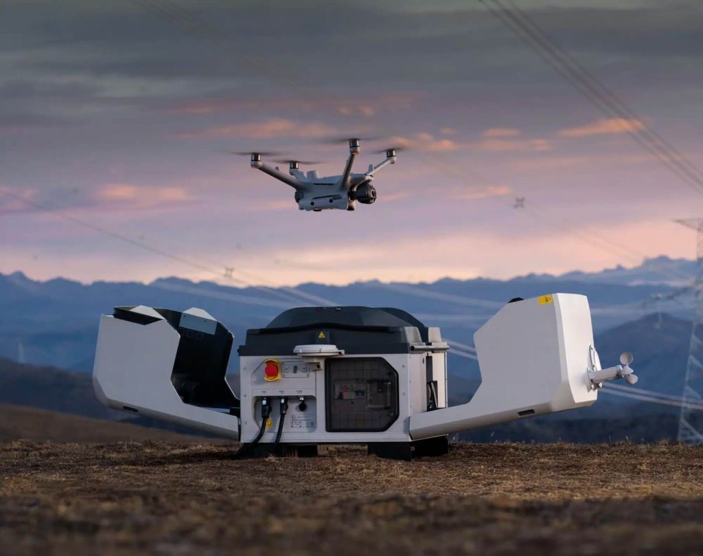
DJI Enterprise has released a comprehensive white paper providing mining operators with a practical roadmap for transitioning from manual drone operations to fully automated Beyond Visual Line of Sight (BVLOS) workflows using the DJI Dock system. The guide features real-world case studies from Australian mining operations, demonstrating significant productivity gains and enhanced worker safety.
Background: A $3 Trillion Industry Goes Autonomous
The white paper arrives at a significant moment. Global mining generated over $3 trillion in revenue in 2023, and operators worldwide are seeking ways to increase efficiency while reducing personnel exposure to the inherently hazardous environment.
Measured Efficiency Gains in Real Operations
DJI’s white paper documents specific productivity metrics from Australian mining deployments. Testing found that automated DJI Dock workflows reduced blast post-photogrammetry survey time from 1.2 hours to just 30 minutes compared to manual drone operations.
- 60% reduction in blast survey time (1.2h → 30 min)
- 150–200 automated flights per Dock system per month
- Up to 50 hours of total flight time per Dock per month (based on 8-hour shifts)
- 94% reduction in data processing time via automated ground control point marking
Case Study 1: Rio Tinto Gudai-Darri Iron Ore Mine, Pilbara
The Gudai-Darri mine represents Rio Tinto’s most technologically advanced iron ore operation, already operating autonomous trucks, drills, water carts, and heavy freight trains — all monitored remotely from Perth, over 1,500 km (932 miles) away.
- Location: Pilbara Region, Western Australia
- Conditions tested: Extreme heat up to 50°C (122°F), pervasive magnetic dust, cyclone-prone weather patterns
- DJI Dock application: Remote flight monitoring and automated charging enabled data-driven decision-making, improving worker safety and operational efficiency
Case Study 2: Norton Gold Fields Paddington Operation, Kalgoorlie
At the Paddington operation near Kalgoorlie in the Western Australian goldfields, DJI Dock conducted aerial surveys of blast post-blocks. Leveraging AI-driven modeling, operators improved grade control, reduced ore dilution, and identified higher-quality ore for the processing plant — directly lowering processing costs.
- Location: Near Kalgoorlie, Western Australian Goldfields
- Processing capacity: 3.73 million tonnes per year
- DJI Dock application: AI-powered ore pile volume measurement and blast movement analysis for safer restart procedures and improved grade control
Navigating BVLOS Regulatory Requirements
A significant portion of the DJI white paper addresses regulatory navigation and operational infrastructure requirements for scaling automated BVLOS operations. The guide covers licensing pathways including remote pilot license requirements, BVLOS approvals, operations outside controlled airspace, instrument rating examination eligibility, and SORA-based BVLOS approvals.
Australia’s Civil Aviation Safety Authority (CASA) framework allows qualified operators to self-assess BVLOS operational sites — dramatically reducing approval timelines from months to days, a stark contrast to the regulatory environment in other markets.
End-to-End Automation Implementation Roadmap
DJI’s white paper provides detailed guidance on building end-to-end automated mining workflows based on the DJI Dock hardware platform and FlightHub 2 flight control software. Operators can use DJI Dock to plan missions remotely, schedule flights in advance, and pilot docked drones on-demand when situations require an immediate aerial perspective.
The document includes step-by-step breakdowns of automated data processing integration with existing photogrammetry software platforms, automated volumetric stockpile measurements using geotechnical models, standardized data capture protocols across multiple sites, and consistent reporting frameworks.